Digital Twins of Putrajaya's Trees (Smart Tree Inventory)
Platform Kembar Digital berasaskan pengimbasan LiDAR 3D dan penderia IoT untuk mendigitalkan dan menguruskan keselamatan aset hijau bandar secara proaktif
Overview
Putrajaya, the federal administrative capital of Malaysia, is home to over 700,000 trees — a defining element of the city’s “City in a Garden” identity. Historically, managing this vast green asset was a labour-intensive, reactive process that struggled to detect risks proactively, monitor tree conditions in real-time, or support strategic long-term environmental planning. The AI Cities: Smart Tree Inventory & Risk Monitoring initiative transforms this landscape entirely, establishing Malaysia’s most advanced municipal urban forestry management system.
In collaboration with Greehill, MapsKart Technology, and with support from the Malaysia Digital Economy Corporation (MDEC), Perbadanan Putrajaya has deployed an integrated AI, Mobile LiDAR, Digital Twin, and IoT system to modernize urban forest governance — establishing a data-driven, proactive asset management framework for the federal capital’s green infrastructure.
System Architecture
The technical backbone of this initiative integrates three precision layers:
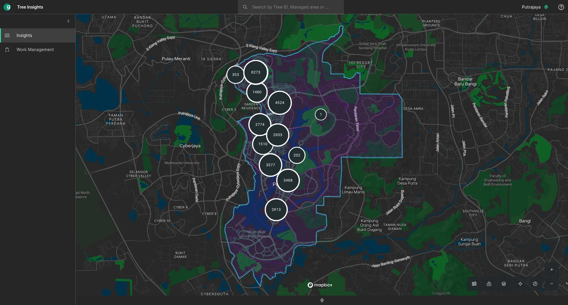
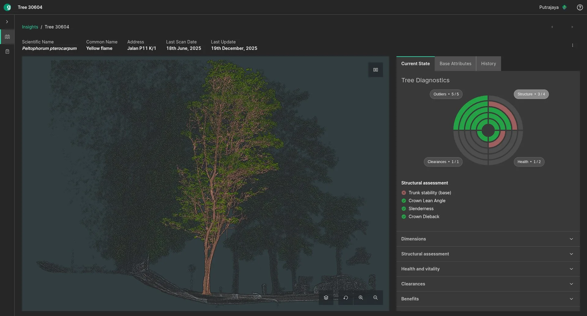
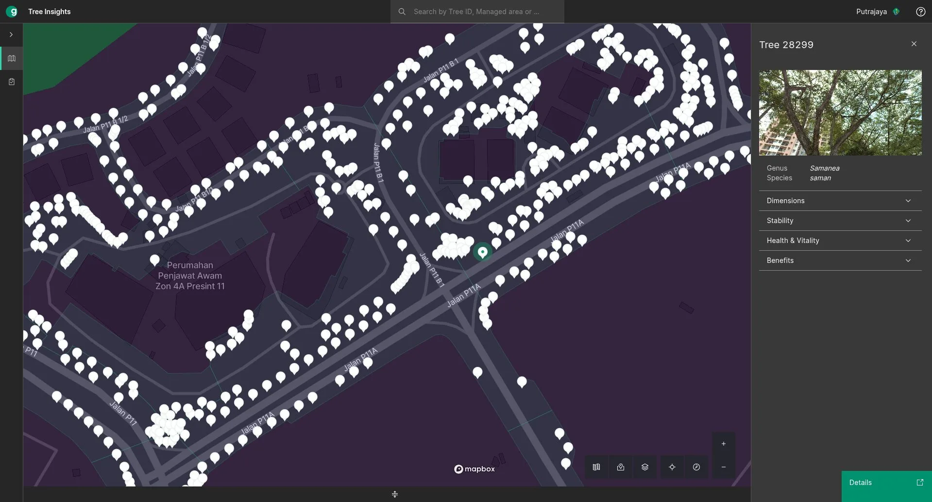
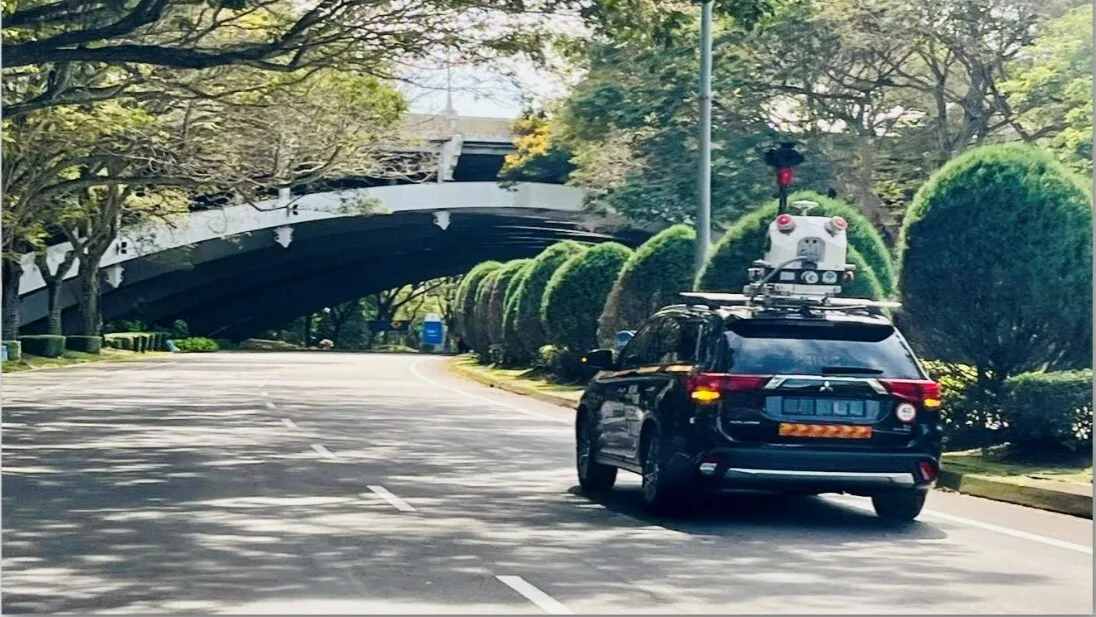
Layer 1 — Digital Inventory (Greehill AI Platform & Mobile LiDAR) Greehill’s AI-powered Mobile LiDAR platform performed comprehensive 3D scanning across Putrajaya’s urban canopy. To date, 29,000 trees have been digitally inventoried and modelled into a high-fidelity digital twin — capturing geolocation, species classification, height, crown spread, structural condition, and carbon sequestration capacity. Each tree is assigned a unique digital record within a centralised spatial database.
Layer 2 — Real-Time IoT Hazard Monitoring (MapsKart IoT Tilt Sensors) 100 IoT tilt sensors manufactured and deployed by MapsKart Technology were installed on identified high-risk trees. These sensors provide continuous, real-time structural monitoring — detecting micro-movements, abnormal tilt angles, and vibration anomalies indicative of imminent structural failure. Alerts are transmitted via the municipal LoRaWAN network directly to the Putrajaya Command Centre (PCC) operations dashboard.
Layer 3 — Centralised AI Intelligence Dashboard A unified management platform integrates all data streams into a single operational view, delivering:
- Automated risk classification — trees ranked by failure probability for prioritised maintenance scheduling
- Carbon sequestration tracking — AI-computed urban canopy CO₂ absorption metrics aligned to Putrajaya’s net-zero commitments
- Predictive maintenance workflows — data-driven resource allocation replacing reactive, costly manual inspections
- Cross-departmental analytics — shared intelligence eliminating siloed decision-making across landscape, safety, and environmental departments
Strategic Impact & Outcomes
This initiative has delivered transformative outcomes across three strategic dimensions:
| Pillar | Achievement |
|---|---|
| Public Safety | Early-warning hazard detection prevents tree-fall incidents — protecting citizens and civil infrastructure across Putrajaya’s parks and public spaces |
| Operational Efficiency | Automated inventory and AI risk scoring eliminate labour-intensive manual inspections, reducing operational costs and response lag times |
| Climate Resilience | Verified carbon sequestration data provides evidence-based environmental reporting — directly supporting Malaysia’s nationally determined contributions (NDC) under the Paris Agreement |
Key Highlights
Technology Stack