Parking Guidance System (PGS)
IoT-Enabled Real-Time Parking Availability Across Putrajaya's 53-Location Public Parking Network
Overview
Real-Time Parking Intelligence Across Putrajaya’s Urban Core
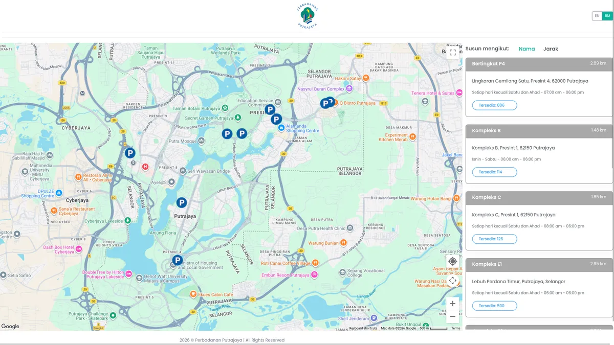
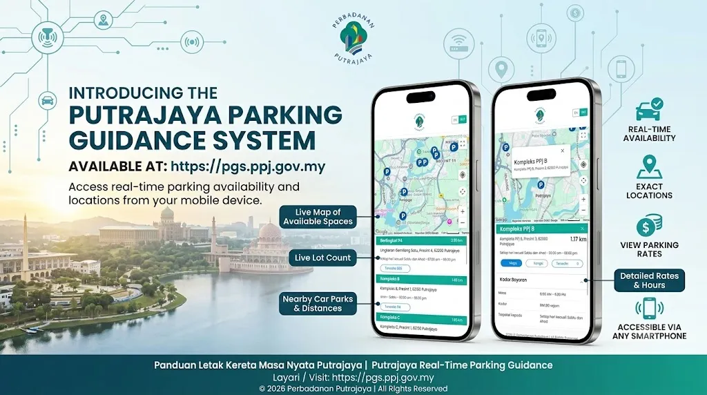
The Parking Guidance System (PGS) is Perbadanan Putrajaya’s IoT-driven urban parking intelligence platform — providing real-time bay availability data to drivers through roadside LED displays and a public-facing web application at pgs.ppj.gov.my. The system targets the reduction of cruising-for-parking traffic, which contributes significantly to urban congestion and vehicle emissions within Putrajaya’s densely trafficked civic precincts.
Putrajaya’s Complete Public Parking Inventory
| Category | Locations | Parking Bays | Facility Types |
|---|---|---|---|
| PPj (Perbadanan Putrajaya) | 30 lot | 8,928 petak | Open + Multi-Storey |
| Swasta (Private) | 23 lot | 11,287 petak | Open + Multi-Storey |
| JUMLAH KESELURUHAN | 53 lot | 20,215 petak | — |
Of the 53 total locations, 12 are equipped with the PGS real-time availability system — all within the PPj-owned estate. The remaining 41 facilities (predominantly private operators) continue to operate without live IoT-linked availability reporting, representing the active expansion pathway for the PGS programme.
The 12 PGS-Equipped Parking Facilities
Perbadanan Putrajaya has deployed PGS across 12 public parking locations, each equipped with:
- IoT ingress/egress counting sensors (LoRaWAN-connected) at bay entry/exit lanes
- Live bay occupancy count transmitted continuously to the PGS central server
- Data feed to pgs.ppj.gov.my and CEBB Smart Mobility Hub display panels
The 12 PGS locations are concentrated at key civic, commercial, and government precinct facilities to maximise commuter impact, particularly around Kompleks Putrajaya, Presint 3 (administrative core), Alamanda Shopping Centre, and major event venues.
System Architecture
IoT Sensor Layer — LoRaWAN Network
Each PGS-equipped parking facility deploys ingress/egress IoT counting sensors installed at vehicle entry and exit lanes. These sensors:
- Transmit real-time occupancy data over Putrajaya’s municipal LoRaWAN network — a low-power wide-area IoT backbone maintained by Bahagian TMK
- Enable sub-minute latency bay count updates without requiring high-bandwidth infrastructure
- Operate on ultra-low-power protocols for long-term unattended deployment
PGS Web Application — pgs.ppj.gov.my
The PGS web application is a responsive, mobile-optimised dashboard that aggregates:
- PPj-owned facilities: Real-time bay counts from LoRaWAN IoT sensors
- Private operators: Parking availability pushed via Open API integration (KLCC Parking Management, Pulse Parking)
- Data refreshed continuously — drivers can check live availability before departing
PGS LED Display Boards — On-Road Guidance
Dynamic PGS LED display boards are installed at strategic road intersections and approach corridors, showing:
- Directional arrows pointing to available parking zones
- Live bay count for nearby facilities
- Colour-coded availability status (green / orange / red)
This on-road signage layer serves drivers who are already en route and may not have accessed the digital platform.
CEBB Smart Mobility Hub Integration
PGS real-time parking data is also streamed to the CEBB Smart Mobility Hub — Putrajaya’s network of smart bus-shelter panels located near major parking facilities. Commuters waiting at bus stops can view live parking availability for adjacent car parks, enabling multimodal trip planning.
Putrajaya Command Centre (PCC) Integration
Parking occupancy telemetry from all 12 PGS locations is monitored at the Putrajaya Command Centre (PCC), enabling:
- Centralised awareness of city-wide parking stress during peak hours and major events
- Event traffic management — proactive VMS message updates when key parking locations are full
- Historical utilisation analytics for infrastructure planning
Strategic Alignment
| Framework | Alignment |
|---|---|
| MSCF Component | Smart Mobility — Real-Time Parking (K4) |
| PSCB Application | Smart Application 1.1: Parking Guidance System |
| PSCB Thrust | Thrust 1: Smart Transportation & Mobility |
| RPP2050 Polisi | P5: Rangkaian Mobiliti Bandar Bersepadu (Teras 3 — mobiliTi) |
| MS ISO 37122:2019 | IND-41 (K4) — 22.6% (12/53 facilities with real-time system) |
| SDG Targets | SDG 11.2 (Accessible urban mobility); SDG 13.2 (Climate action in urban planning) |
| Legal Basis | Akta Pengangkutan Jalan 1987; Perintah Pengangkutan Jalan (Peruntukan TLK) WPP 2002 |
| IOC Integration | PGS telemetry monitored at PCC for event/peak-hour traffic management |
| Data Protection | PDPA-compliant; no personal vehicle or individual data collected; aggregate bay counts only |
PSCB Blueprint Alignment
This initiative is classified under Smart Application 1.1 — Parking Guidance System in the Putrajaya Smart City Blueprint.
Objective: Provide information on available car parking spaces and their location across the city.
Desired Outcomes:
- Reduce circulating traffic caused by drivers searching for parking, especially during peak hours and major civic events
- Deliver convenience for drivers through pre-departure digital parking intelligence
- Improve traffic flow on primary road corridors approaching high-demand precinct zones
Implementation Approach:
- Display real-time total availability per parking facility during peak hours
- Integration with MyPutrajaya app and Putrajaya Park-by-Phone (directional guidance to parking)
- Integration with enforcement systems (clamping and towing operations)
- Expansion of PGS to remaining 41 non-equipped public facilities as Phase 2 rollout
Key Highlights
Technology Stack