Putrajaya Architectural Archive System (Arkib Senibina Putrajaya)
Putrajaya's phased digitisation programme preserving 81,345 architectural approval plans and producing BIM-based measured drawings of iconic landmarks — safeguarding the city's built heritage for future generations.
Overview
Perbadanan Putrajaya has embarked on a systematic digitisation and archival programme to preserve the city’s architectural heritage — scanning, digitising, and storing over 81,345 physical approval plans that were submitted in hardcopy format since Putrajaya’s founding in 1995 through to 2022, before the full transition to the OSC 3.0/4.0 online submission system.
This initiative directly responds to the risk of data loss, information inconsistency, and the urgent need to safeguard Putrajaya’s development records for future planning, conservation, and auditing purposes. By transitioning from physical to digital archives, Perbadanan Putrajaya ensures that the city’s built heritage remains accessible, secure, and searchable for decades to come.
Project Overview
The Putrajaya Architectural Archive System (Arkib Senibina Putrajaya) is a structured, multi-phase digitisation initiative managed by Perbadanan Putrajaya. It covers the scanning, preservation, and systematic storage of physical architectural approval plans — including building approvals, planning permits, landscape approvals, and infrastructure records — dating from Putrajaya’s establishment through the pre-digital era of development administration.
The system is operated under the Bahagian Teknologi Maklumat dan Komunikasi (BTMK) and serves as the primary repository for all development-related data from Putrajaya’s founding period. In parallel, the initiative also encompasses the production of Lukisan Terukur (measured drawings) of iconic Putrajaya landmarks using 3D laser scanning and Building Information Modeling (BIM) technology.
Digitisation by Category
Phase 1 (2025) successfully digitised a total of 81,345 plan sheets across three divisions:
| No. | Division | Department | Application Types | Plans Digitised |
|---|---|---|---|---|
| 1 | Bahagian Senibina & Inspektorat Bangunan | Jabatan Perancangan Bandar | MB, PP MB, Infrastruktur, Landskap, KMPB | 38,141 |
| 2 | Bahagian Kawalan Perancangan Dan Pembangunan | Jabatan Perancangan Bandar | KMPB, Pelan Susun Atur | 31,266 |
| 3 | Bahagian Perancangan Dan Pembangunan Taman | Jabatan Landskap Dan Taman | Kelulusan Landskap | 11,938 |
| TOTAL | 81,345 |
MB = Mendirikan Bangunan; PP MB = Pindaan Pelan Mendirikan Bangunan; KMPB = Kebenaran Merancang Pendirian Bangunan
Implementation Phases
Phase 1 — Digitisation of Physical Approval Plans (2025)
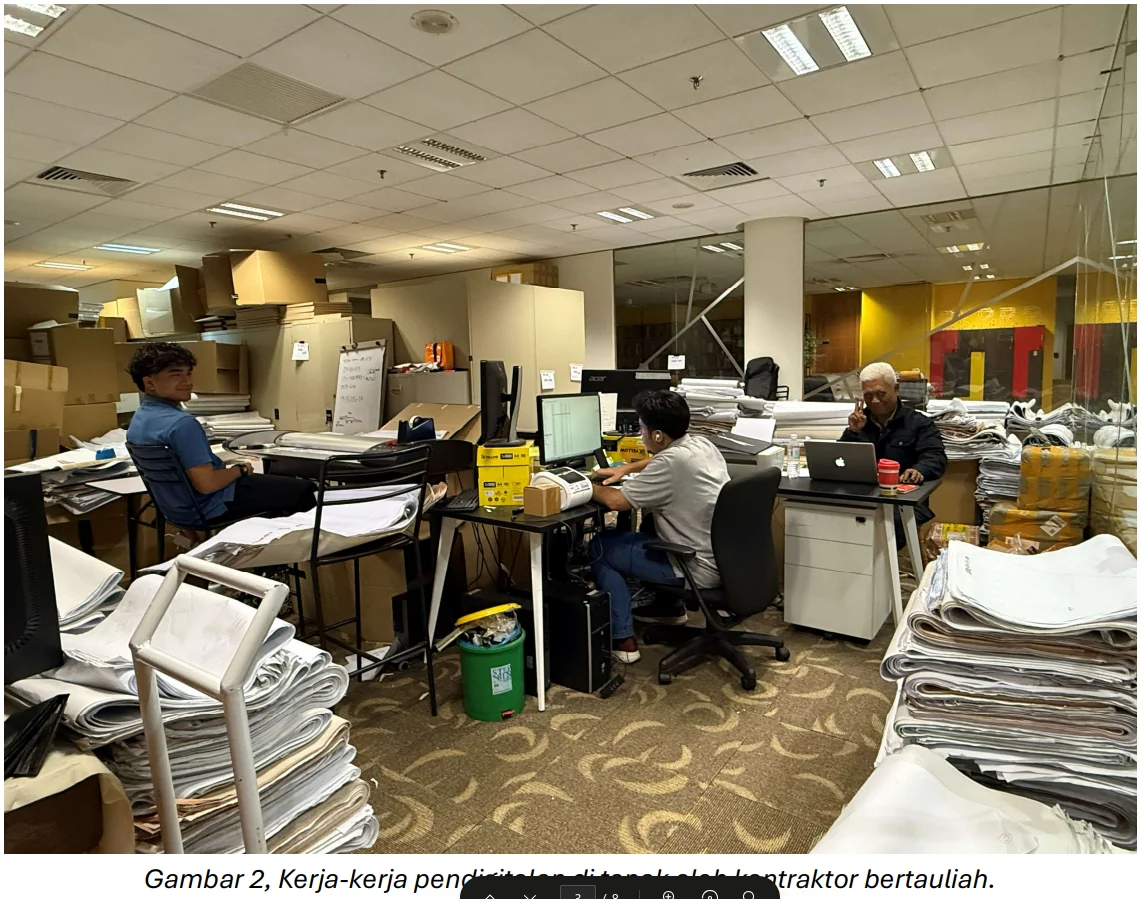
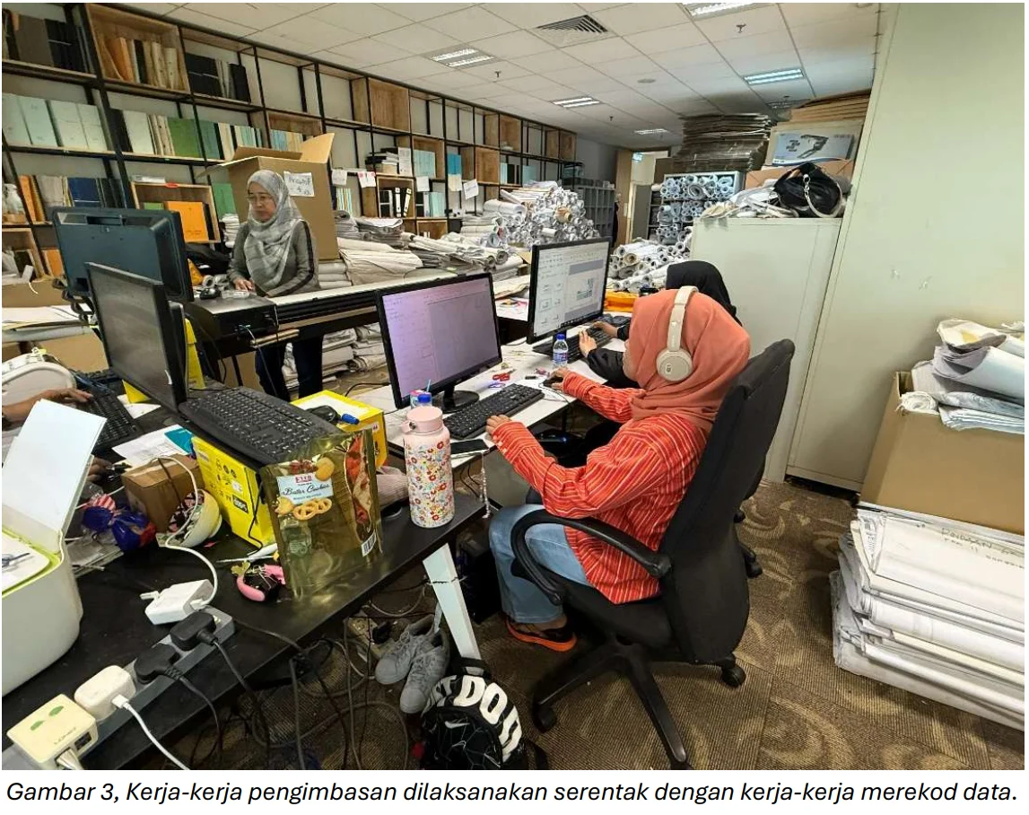
The first phase involved the comprehensive scanning and digitisation of physical approval plans that had been submitted in hardcopy format from Putrajaya’s founding (1995) to 2022. A certified contractor was engaged by Bahagian Senibina & Inspektorat Bangunan to carry out scanning, preservation, recording, and conversion of documents from physical to digital format.
All digitised data is currently stored in Perbadanan Putrajaya’s cloud storage on an interim basis, pending full migration to the Arkib Senibina Putrajaya system upon its completion and operationalisation by BTMK.
Phase 2 — Building Facade & Signage Records (2026)
The second phase, planned for 2026, will expand the digitisation scope to include:
- Building facade lighting reports (laporan lampu fasad)
- Building colour schemes (skema warna bangunan)
- Building signage records (papan tanda bangunan)
This phase will be managed by Bahagian Kawalan Bangunan dan Rekabentuk Bandar, ensuring continuity across architectural control functions.
Phase 3 — Historical Records & Manuscripts (Future)
The third phase will focus on high-value historical and reference documents, including:
- Old manuscripts and archival records
- Historical photographs
- Legacy records relating to the founding and early development of Putrajaya
This phase aims to comprehensively preserve Putrajaya’s urban development heritage for scholarly reference, conservation planning, and cultural tourism.
Measured Drawings (Lukisan Terukur)
Beyond mass digitisation, Perbadanan Putrajaya — through Bahagian Kawalan Bangunan dan Rekabentuk Bandar — has undertaken the production of precision measured drawings for selected iconic buildings, addressing gaps in comprehensive documentation and historical record inconsistencies.
Two buildings have been completed:
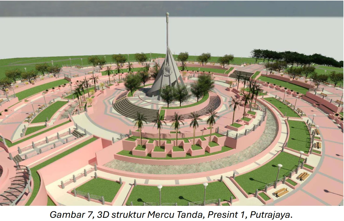
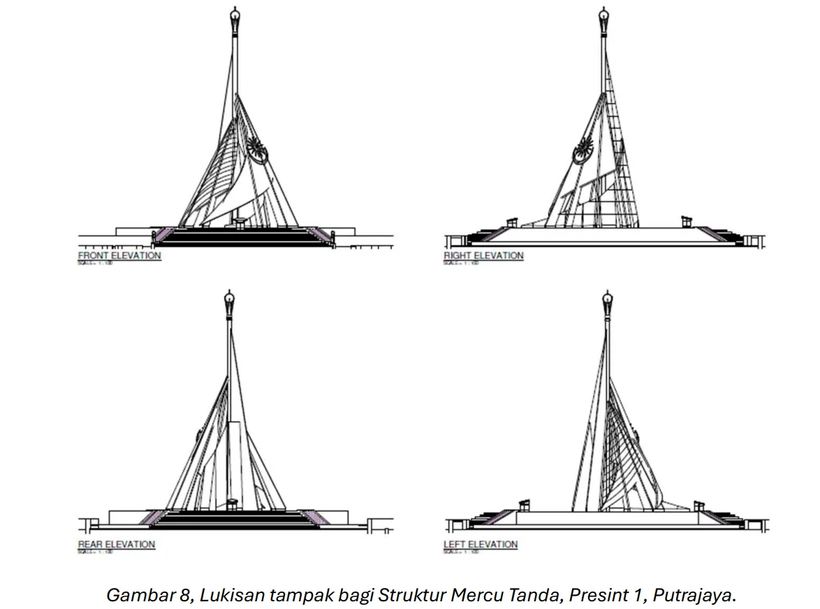
1. Mercu Tanda Putrajaya (Presint 1)
3D laser scanning services were carried out at the iconic Putrajaya landmark to obtain precise dimensional data. The resulting point-cloud data was subsequently modelled in Building Information Modeling (BIM) format for documentation, visualisation, and heritage conservation purposes.
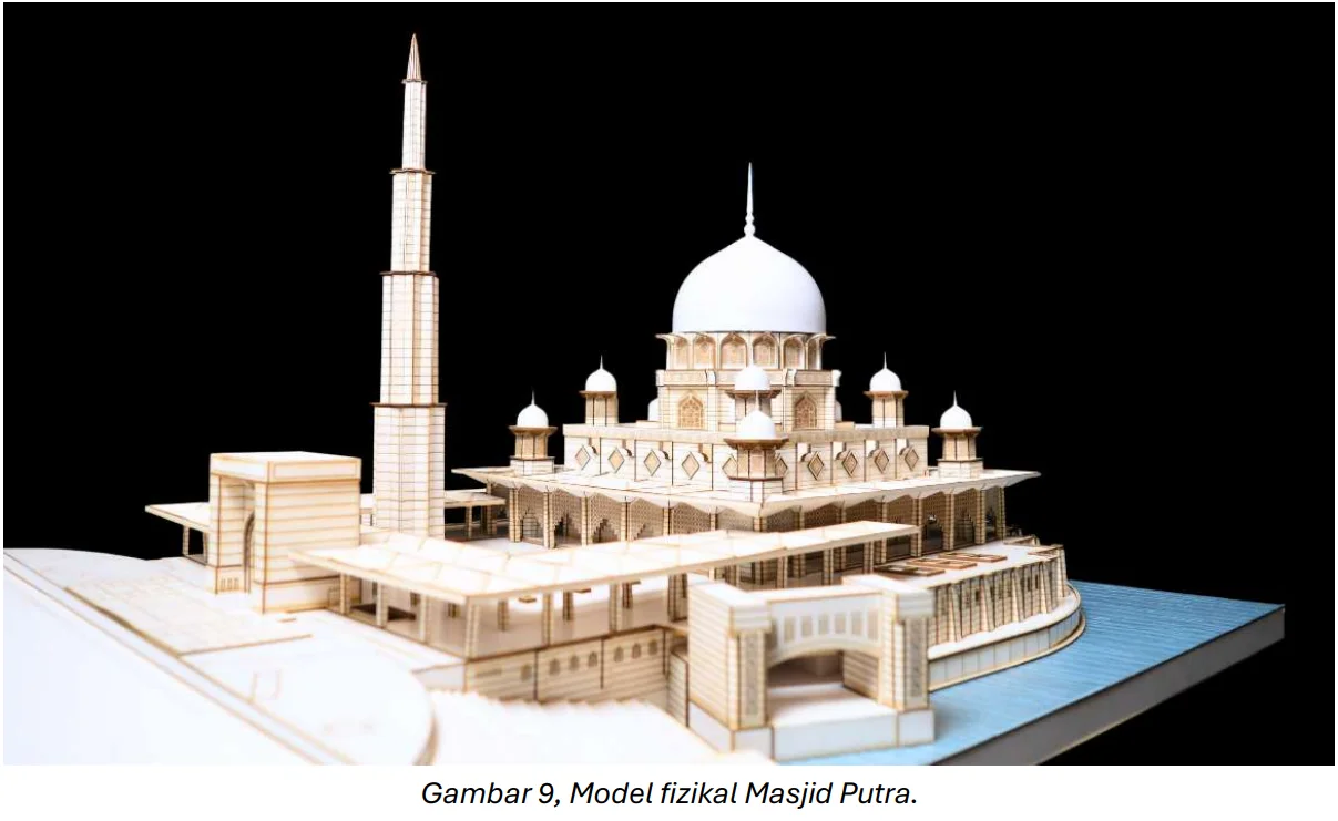
2. Masjid Putra
The structure of Masjid Putra was fully modelled using Building Information Modeling (BIM) and subsequently translated into a physical scale model for enhanced visualisation and a more comprehensive understanding of its structural systems and architectural composition. This model supports conservation planning, heritage declaration, and architectural appreciation.
The measured drawings programme directly addresses:
- Absence of comprehensive documentation for landmark structures
- Inconsistencies in historical architectural records
- The urgent need to preserve and reinforce Putrajaya’s architectural identity as both a national heritage asset and a cultural tourism product
Technology & Infrastructure
| Component | Detail |
|---|---|
| Digitisation Method | High-resolution document scanning by certified contractor |
| 3D Capture Technology | 3D Laser Scanning (point-cloud acquisition) for Mercu Tanda |
| Modelling Platform | Building Information Modeling (BIM) |
| Interim Storage | Perbadanan Putrajaya Cloud Storage (government-managed) |
| Target System | Arkib Senibina Putrajaya (BTMK-managed repository) |
| Output Formats | Digital plan files, BIM models, physical scale models |
PSCB Blueprint Alignment
This initiative is classified under Smart Government Services within the Putrajaya Smart City Blueprint (PSCB), contributing to the city’s data-driven governance agenda.
Strategic Objective: Establish a comprehensive, secure, and searchable digital repository of Putrajaya’s architectural development records — enabling efficient regulatory reference, heritage conservation planning, and long-term data sovereignty.
Desired Outcomes:
- Complete digital preservation of 81,345 approval plans from Putrajaya’s founding era, eliminating the risk of physical record deterioration or loss.
- A centralised Arkib Senibina Putrajaya system providing authoritative data on Putrajaya’s built environment to all relevant divisions.
- Precision BIM documentation of iconic Putrajaya landmarks, supporting heritage conservation, civic education, and cultural tourism development.
- Phased expansion to cover facade, signage, historical, and manuscript records by Phase 3.
Blueprint Status: In Implementation (Phase 1 Complete; Phases 2–3 Planned)
Strategic Framework Alignment
| Framework | Alignment |
|---|---|
| MSCF Component | Smart Government — Data-Driven Governance |
| PSCB Thrust | Thrust 3: Smart Government Services |
| MS ISO 37122:2019 | Indicator 54 (K4): Number of the city’s cultural records that have been digitised |
| SDG 11 | Make cities inclusive, safe, resilient, and sustainable |
| SDG 16 | Promote accountable and transparent institutions |
| SDG 17 | Strengthen data partnerships for sustainable development |
Regulatory & Standards Framework
| Standard / Policy | Relevance |
|---|---|
| MS ISO 37122:2019 | Smart city cultural record digitisation indicator (IND-54) |
| Malaysia Smart City Framework (MSCF) | Smart Government component — data management & preservation |
| Putrajaya Smart City Blueprint (PSCB) | Thrust 3: Smart Government Services |
| National Digital Economy Blueprint | Digital record management and archival standards |
Key Highlights